Uluṟu-Kata Tjuṯa National Park
Uluṟu-Kata Tjuṯa National Park
The nearest town is 335 km (208 mi) away from the park’s borders. Does this mean that Uluru-Kata Tjuta is merely a wilderness? Many years ago, that was the prevailing opinion. At the beginning of the 1950s, it was even determined that the area was worthless in terms of landscape and tourism.
The rock formations admired today were then dismissed as “piles of stones that nobody will want to see.” Half a century has passed since then, and it has become clear that those who doubted the beauty of Uluru-Kata Tjuta were mistaken.
Location
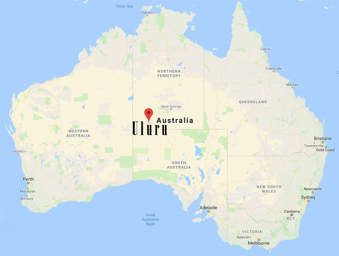
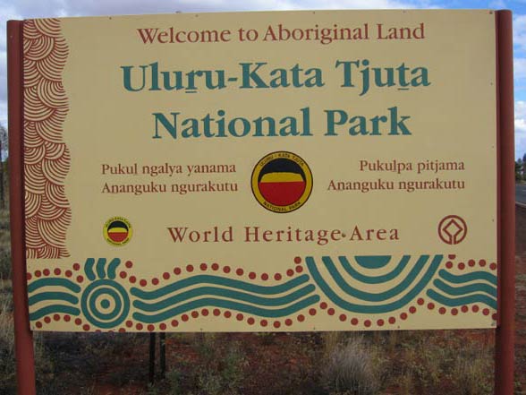
The exotic-sounding name of the national park is no accident. It is located in one of the most extraordinary countries in the world – Australia – or, more precisely, in its central part. This area, including the park itself, is the ancestral home of the Indigenous Aboriginal people of the Anangu tribe.
It is worth noting that the park’s territory belongs to them both symbolically (as the original inhabitants) and legally. The Anangu people granted a 99-year lease of the park area to the Australian government, which had returned the land to them a few years prior. Today, the Aboriginal people manage the park in cooperation with the Australian National Parks and Wildlife Service.
Area
Uluru-Kata Tjuta covers an area of about 1333 km2 (515.0 sq mi), where you will meet unique rock formations. Thanks to them, Uluru-Kata Tjuta attracts several hundred thousand (250 000-700 000) tourists from all over the world every year.
Name
Uluru and Kata Tjuta are names of the most famous attractions of the Australian park. It’s about specific rock formations, called inselbergs, monadnocks or monoliths by scientists.
Climate and bush tucker
In the photographs, the landscape of Uluru-Kata Tjuta seems harsh, but in reality, it is vibrant with life. Many animal and plant species have adapted to extreme weather conditions, creating a unique ecosystem. Vegetables, fruits, nuts and herbs are part of this ecosystem and serve as food and medicine for the indigenous peoples of Australia.
Due to their impressive diversity, they have their own name, the bush tucker, which can be translated as ‘bushfood’. Bush tucker also includes the meat of certain animal species, including kangaroos, crocodiles and Emu. Currently, bush tucker is sold widely in supermarkets, but not all of the products included in ‘bush food’ are found there.
Fauna and Flora
The area of the National Park is extremely rich in unique plant species (flora) and animals (fauna).
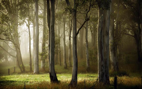
Plants growing on Uluru-Kata Tjuta are often endemic species, characteristic only for the region of the park and its surroundings. We also encounter rare and endangered species.
There is a merciless, desert climate in the park, which is why the plants present there had to adapt to very difficult conditions. Some of them are able to survive fires, while in others plants fires play an important role during pollination.
Plant communities occurring in Uluru-Kata Tjuta can be divided into four categories. Each of them has its own name:
- Punu – includes trees (mainly acacia called common sponge, creating scrubs characteristic of the Australian landscape, besides the Camaldulans eucalyptus or desert oaks)
- Puti – shrubs (you can also include shrubs of acacia – mulga)
- Ukiri – grass (mainly spinifex, or spherical green communities or blue-gray grasses, is the hallmark of the continent)
- Tjulpun-tjulpunpa – flowers (e.g. Asteraceae – sunflower family)
In the past, 46 species of native mammals lived in the park, however, recent analyzes have shown that this number has fallen to 21. People from the Anangu tribe believe that the reason for reducing the number of mammals is the deteriorating condition of the natural environment and the introduction of foreign invasive species. Activists for the park are doing a lot to restore extinct animals, including: rabbit-bandicoots from the Thylacomyidae family, black-flanked rock-wallaby (Petrogale lateralis) or malleefowl (Leipoa ocellata). Tourists can still find, for example, Marsupial moles from Notoryctidae family and the woma python (Aspidites ramsayi).
In Uluru-Kata Tjuta there are also 7 species of bats, as many as 73 species of reptiles (including monitor lizards, e.g. perentie (Varanus giganteus)), 178 species of birds and 4 species of frogs.
Alien species of mammals include: home mouse, domestic cat, domestic dog, rabbits (representatives of the family of Leporidae), fox and … camel. They are responsible for the reduction of Australian vegetation, therefore the park authorities prohibit the introduction of any domestic animals, except for guide dogs, or allow them to show special permission granted by the director of national parks.
Kata Tjuta
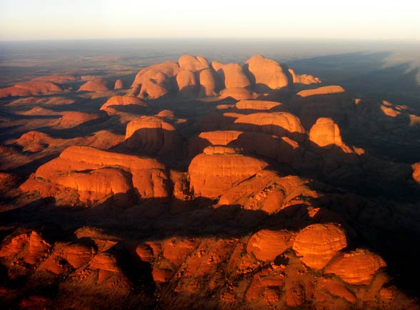
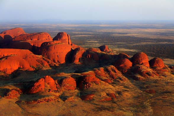
Kata Tjuta, also called Olgas, does not refer to one object, but a group of 36 monoliths – various domed rock formations. They are located over 360 km southwest of Alice Springs – the 3rd largest city in the Northern Territory. Kata Tjuta is also one of two – next to Uluru – the main landmarks of the park.
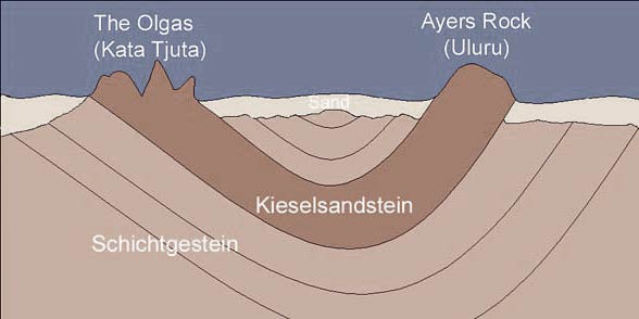
Rock formations occupy about 35 km2. The rocks are built of, among others from basalt and granite, and their “cement” is sandstone.
The highest rock within Kata Tjuta – Mount Olga, rises to a height of 1,066 m above sea level and about 546 m above the surface of the plain. Kata Tjuta rock base is located underground. It is estimated that the foundation lies at a depth of about 2 to 6 km. The circumference of the whole formation is about 24 km.
The alternative name of the mountain range (and the highest peak) – Olga – refers to the daughter of Tsar Nicholas I, wife of King Charles I of Württemberg. The name was given by Ernest Giles on the orders of Baron Ferdinand Mueller. A year before the name was given, the king and queen of Württemberg gave Mueller the title of baron (which made him von Mueller). As a sign of gratitude, the baron decided to give the Australian mountain the name of the queen.
“Many heads”
Kata Tjuta translates as “Many heads”. Convex rock formations resemble, therefore, protruding from the ground heads, which, depending on the angle of the sun, change the color of the “skin”. During the day, they appear to be pale brown, but at sunrise and sunset, they acquire an intense orange color. You can walk between the “heads” on one of the two routes developed: the 6-kilometer long Valley of Winds or the 2-kilometer long Mt Olga Gorge.
Uluru
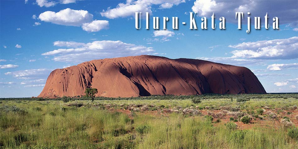
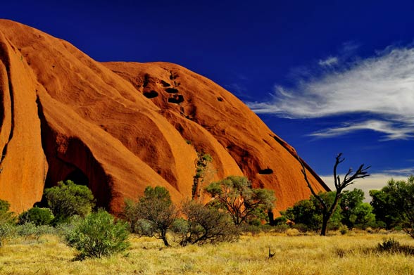
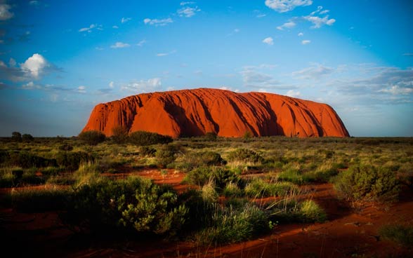
The second, next to Kata Tjuta, a trademark of the national park is Uluru, often called Ayers Rock or Oolora. In this case, we are dealing with one high mountain made of sandstone similar (but not identical) to that of which the Kata Tjuta is made.
Uluru is 863 m above sea level, 348 m above the plain and has a circumference of more than 9 km. The base of the rock is located about 2 km underground.
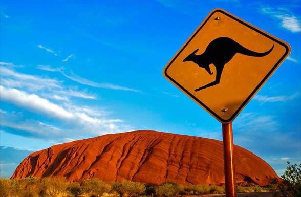
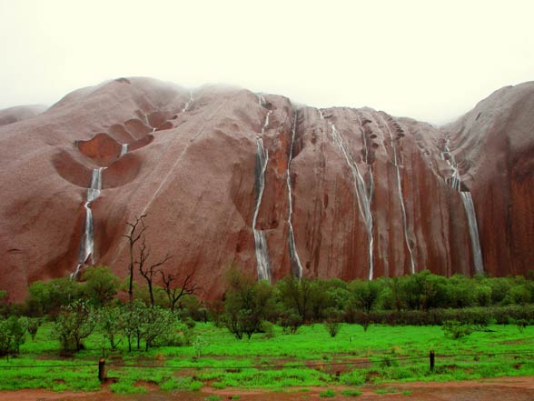
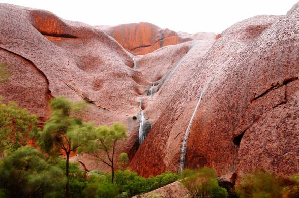
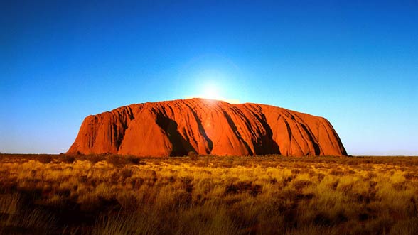
Depending on the time of day and year, Uluru changes its color. The rock is grey in color, but as a result of the oxidation of the iron, the surface of the rock becomes brick in color. During sunrises and sunsets, it takes on an intense shade of orange, red and even gold. If it rains, Uluru becomes light grey or silver. In addition, during a downpour on a very steep mountain slope (with an angle of inclination close to 80°), loud, impressive waterfalls are formed.
Uluru, otherwise Ayers Rock
The original name has its roots in Aboriginal language, called Yankunytjatjara. Uluru does not mean anything specific, so the name cannot be translated into another language. The words of Uluru Aborigines are rather used to describe the area surrounding the summit.
Ayers Rock is a name in memory of Sir Henry Ayers, the Chief Secretary of South Australia.
Deadly beauty
Entering Uluru turns out to be a big challenge for tourists. As we have already mentioned, the slopes of the mountains are very steep and therefore dangerous. Only one approach is suited to climbing to some extent. However, it has been additionally secured with chains. In spite of this, many people die each year during the attempt to reach the summit.
The main problem is not the height of Uluru, but atmospheric conditions, namely very high temperatures in the summer, reaching up to +50oC. Heat, combined with strong wind and bravado of man create a deadly mix, which may result not so much in the fall, but in the exhaustion of the body leading to a heart attack. The park authorities therefore introduced a ban on climbing Uluru during adverse weather conditions.
Holy place
The official ban on climbing Uluru does not cover the key issue for Aborigines. According to the Anangu tribe – the owners of the park – Uluru is a holy mountain, which can be climbed only by some men of the tribe. Other sources also say that even the Aborigines do not enter Uluru, thus worshipping its holiness.
Anangu does not prohibit tourists from climbing Uluru, but they ask not to do so for the sake of respect for Aboriginal culture. It turns out, however, that many tourists have no idea about this unwritten law. Many of them travel hundreds or even thousands of kilometers mainly to enter Uluru. However, the Internet is full of information about the Aboriginal “code”. Therefore, dear reader, if you are going to the Uluru-Kata Tjuta National Park, try to respect the request of the hosts of the place where you will be only a guest.
There are several places in the park that are inaccessible to curious eyes. It is there that various rituals and ceremonies take place. The punishment for the violation of privacy and holiness of these places is to impose very high “fines”, amounting to 2000-5000 Australian dollars.
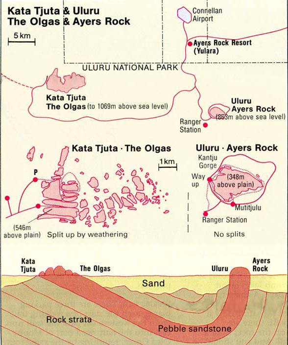
Detailed data
Uluru-Kata Tjuta National Park
- Area: 1333 km2 (515.0 mi2)
- Founded in: 1958 (since 1985 in the hands of Aborigines and Parks Parks Australia)
- Biggest attractions: Uluru monolith and a group of Kata Tjuta monoliths
Kata Tjuta
- Number of peaks: 36
- The highest peak: Mount Olga
- Altitude above sea level: 1066 m (3,497 ft) – Mount Olga
- Height above ground level: 546 m (1,791 ft)
- Overall band circumference: 24 km (15 mi)
Uluru / Ayers Rock / Oolora
- Altitude above sea level: 863 m (2,831 ft)
- Height above ground level: 348 m (1,142 ft)
- Circuit: 9.4 km (5.8 mi)
Uluru-Kata Tjuta National Park – interesting facts
- The National Park is on the UNESCO World Heritage List.
- The formations of Uluru and Kata Tjuta were created on Earth about 300-500 million years ago.
- In Uluru-Kata Tjuta, there is one of the most significant desert ecosystems in the world.
- Uluru is higher than the Eiffel Tower and the New York Chrysler Building.
- The entrance ticket to the park costs 25 Australian dollars for adults and youth from 16 years. The fee allows you to visit the park for 3 days, from dawn to dusk. After each day, the park should be left, because there is a ban on camping in its area.
