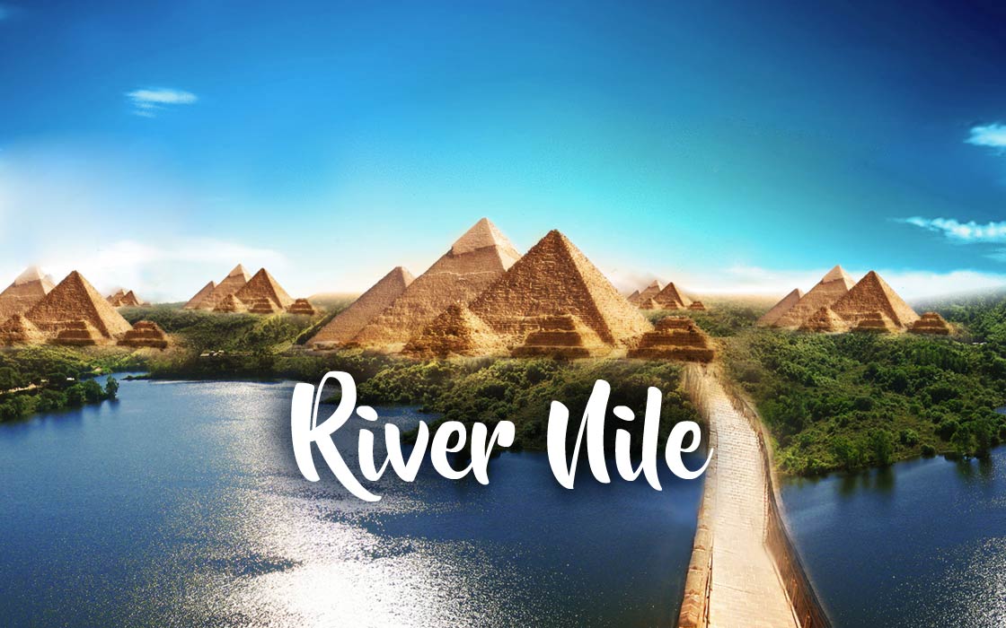
The Nile – the river through which Egypt exists
Probably everyone has heard the saying “Egypt is a gift of the Nile”. It is true insofar as the ancient state would never have developed if it were not for the river and its regular flooding, which Egypt owed its fertile soil. To this day, despite the passage of thousands of years and the development of technology, the country is closely dependent on the Nile.
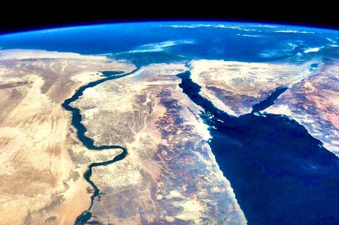
The Nile is the longest (at least according to most sources) river in the world. It flows through central and north-eastern Africa and crosses all climatic zones. According to some sources, the Amazon River may be a bit longer. It flows through five countries (including the Blue Nile – six). It flows through mountainous areas, savannas, swamps and desert until it reaches a vast delta, flowing into the Mediterranean Sea. Since ancient times, Nile has played an extremely important role for the countries located above it – the vast majority of Egyptians live in the river valley.
Name
The Nile in the language of the ancient Egyptians was described by a word read as “Hapy”, which simply means a river. However, Greek writers called her “Neilos” and Roman writers “Nilus.” It is not known where these names came from; probably derived from the name of one of the Greek river gods – the son of the Titans, Okeanos (Oceanus) and Tethys.
The Greek name survived and when the Arabs conquered Egypt, they called it “an-Nile”, and this name was spread throughout the known world at the time. On the other hand, individual sections (e.g. the Victoria Nile) bear the names given to them by explorers looking for the source of the river. In turn, the names “White Nile” and “Blue Nile” come from Arab scholars who named the two rivers joining in Khartoum.
The sources of the Nile
The mystery of the river’s origins aroused interest already in antiquity. The Egyptians were known to travel deep south, but never attempted to find the source of the Nile. The first such attempt was made in the time of Nero, to some extent because of the emperor’s megalomania, but to no avail. Later, only the nineteenth-century travelers decided to thoroughly learn the geography of the Nile valley. Financing the expedition did not run into problems – it was the peak of the world domination of the British Empire, whose authorities wanted to get to know their lands as much as possible, and Egypt was then under the rule of Great Britain.
Richard Burton and John Speke were the first to reach Lake Victoria, which was initially considered the source of the Nile. However, other rivers of comparable size to the flowing Nile were discovered to flow into this lake, so it was concluded that one of these tributaries should be considered the source. Finally, in 1876, Henry Stanley thoroughly explored Lake Victoria and discovered the Kagera River – about 420 km long, the longest of the lake’s tributaries. His expedition proved that it was precisely this, which should be considered the beginning of the Nile.
Upper Nile
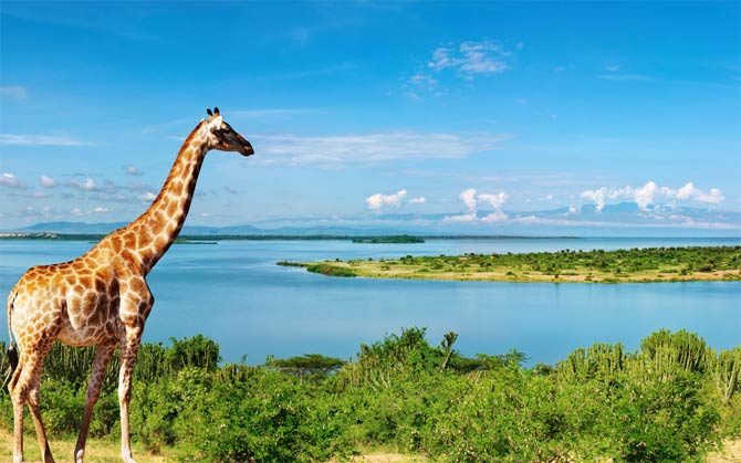
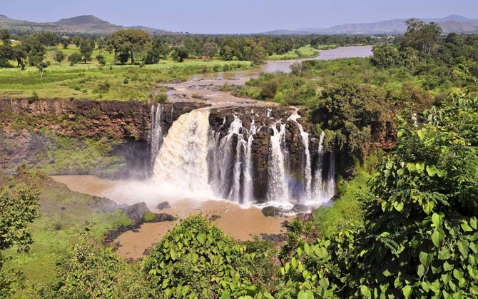
Kagera river arises where the Nyawarong and Ruvuvu streams meet, and then flows around the Great West Rift. After overcoming quite a significant difference in height and many rock steps, it flows into Lake Victoria. The northern side of the lake is the beginning of another section of the river, known as the Victoria Nile (so named by its explorers in honor of the queen who ruled in their time). It covers about 200 km on a rocky surface. There are several water cascades along the way, as well as two large waterfalls – Ripon and Owen. Later on its way, there is Lake Kioga, from which the Victoria Nile ends up in another reservoir – Lake Albert.
The river leaves the Alberta Lakes as the Albert Nile and flows north through the Nimule Valley, which is now a national park. A few hundred kilometers further, it turns in a wide curve to the west, then the Aswa (Achwa) River flows into it. From that moment on, the river changes its name again, this time to the Mountain Nile. From this point on, the river is so wide and deep that even large river ships can navigate it.
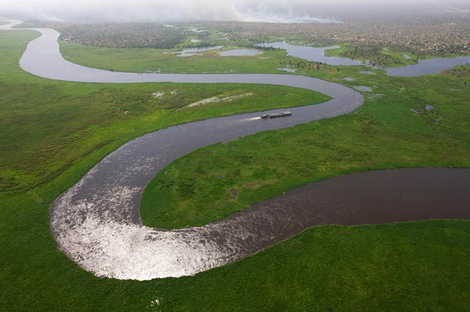
Later, the Nile flows through South Sudan, where it ends up in the marshes of As-Sudd. This area is approx. 320 km long and 240 km wide. Every year it is almost completely flooded by the waters of the Nile, and the river itself creates numerous branches there. This causes most of the water to evaporate, and the Nile, leaving the marshes, has three times less flow. However, a little further, another large river – Bahr el-Ghazal – flows into it and the amount of water in the Nile increases again.
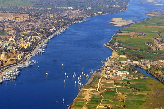
From that moment on, the river is known as the White Nile. It flows first east and then north and flows through Khartoum, where it joins the Blue Nile, which is its largest tributary. Only from this point on, the river is simply called the Nile. Further to the north, it comes across rocks on which famous cataracts form. There are six of them, and they are traditionally marked with Roman numerals towards the headwaters. At this point, the river is navigable only when the water level is high. After the cataracts, it covers nearly 2.5 thousand km, sailing through the Sahara desert.
Lower Nile
According to the division existing since antiquity, the Lower Nile is considered only the last section of the river along which the state called Upper Egypt once stretched. This area covers practically only the Nile delta and a relatively small section preceding it.


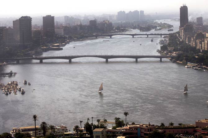
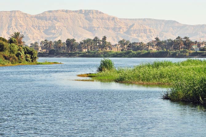
In the lower section, the Nile increases in width, and in the suburbs of Cairo, it begins to branch. It is 175 km to the shore of the Mediterranean Sea from here. The Nile Delta covers an area of 22,000 km2. This area is densely populated and developed. Currently, cotton, rice and wheat are grown here.
Nile and people
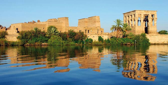
Ancient Egyptian civilization is inextricably linked with the Nile. Due to regular floods, the river left sediments of volcanic origin brought from the south in its valley. Thus, the soils along the river were extremely fertile. Already 6 thousand. years ago, organized cultures flourished in the Nile valley. Later, with the development of the state of the pharaohs, agriculture developed significantly.
In order to take full advantage of the soil and prevent it from drying out, and to distribute the water to the greatest possible extent, an irrigation system was used that was complicated at that time, which in turn required efficient organization and administrative supervision. This, in turn, gave rise to state structures. It can therefore be said that the use of the river even forced the creation of a state. The river was also the main route for transporting goods. All this led the ancient writers to call Egypt “the gift of the Nile.”
Aswan High Dam
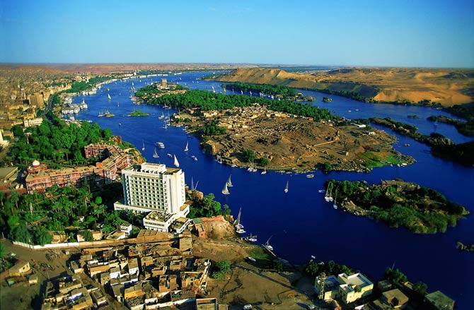
In 1946, the first dam was built in Aswan, one of the most important cities on the Nile, to produce electricity. It turned out to be insufficient, so the construction of another one began. It was supposed to be co-financed by the US, but after Egypt recognized the existence of the People’s Republic of China, the Americans withdrew and the country’s authorities decided to finance the construction with profits from the Suez Canal. In 1960, the Soviet Union promised to help in the form of machines and engineers, hoping to increase its influence in this part of the world. Egyptian authorities agreed to this and construction began. It required the resettlement of over 100,000 people.
The dam aroused protests from archaeologists – its existence was associated with the creation of the artificial lake Nasser, which was to flood many priceless monuments. Therefore, UNESCO has launched an unprecedented operation to move 24 buildings to higher locations, the best-known example of which is the Abu Simbel temple complex.
In 1970, the dam became operational. At the time of launch, it satisfied half of Egypt’s energy needs. It has also provided electricity to many inland villages. In addition, it allowed for the regulation of the level of the Nile, preventing floods and reducing the effects of droughts. Lake Nasser itself has become an important fishing center.
At the same time, the Aswan High Dam stops the settlements, which for thousands of years have been deposited by regular river floods. This resulted in gradual sterilization of the soils in the Nile valley and a shrinking crop range. In addition, the lack of sediment carried by the Nile may contribute to the erosion of the delta and coastlines in the Eastern Mediterranean.
Nile and environmental issues
Currently, the economic use of the Nile is highly controversial due to the vast extent of its valley and the fact that any work on one section affects the downstream communities. For example, the As-Sudd marshes are navigable only by digging a canal, which, however, must be constantly maintained. It was therefore planned to build another canal through which the waters of the Nile would flow, but then the entire region would dry up and be deprived of water. On the other hand, the northern part of the country would benefit significantly from the construction of the canal.
Detailed data
The Nile in numbers
- Length: 6,650 km (4,130 mi)
- Source elevation: elevation 2,400 m (7,900 ft) above sea level
- Basin size: 3,400,000 km2 (1,300,000 sq mi)
- Maximum width: 2.8 km (1.7 mi)
- Average depth: 8–11 m (26–36 ft)
- Flow:
- 2,830 m3/s (at Aswan level)
- 1400 m3/s (Cairo level)
Nile – interesting facts
- In ancient Egypt, crocodiles that lived in the Nile were considered sacred. This was due to the fact that the river itself was considered sacred – so people had a similar attitude to the animals living in it.
- Lake Nasser was called the 10-year lake, because it was believed that in the event of a complete lack of rainfall, it would be a reservoir of drinking water for the Egyptians for 10 years. However, the amount of water in it is constantly decreasing due to the build-up of sediment.
- Below Lake Nasser are the ruins of the city of Hierasykaminos. There was the famous Temple of Maharraqa dedicated to the deities Serapis and Isis. She was moved to avoid being flooded by water.