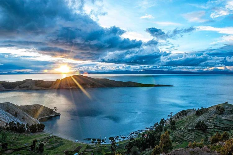
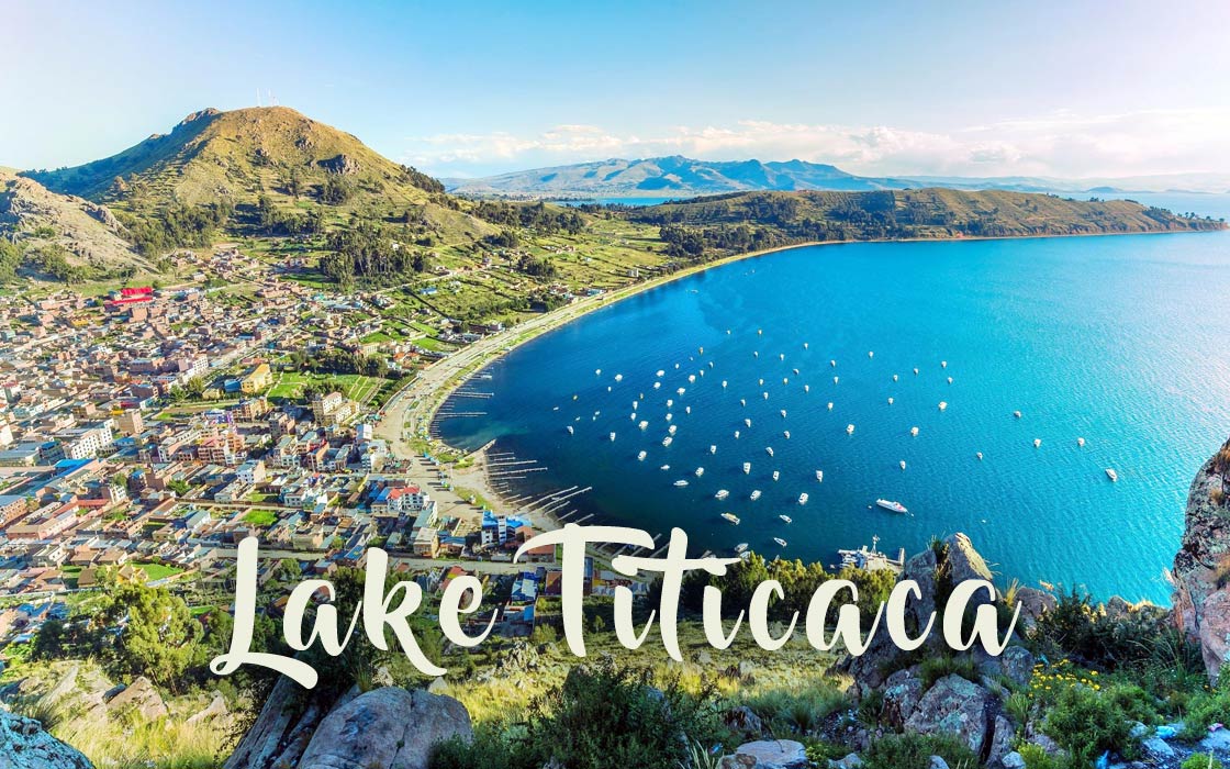
Lake Titicaca – the highest navigable lake in the world
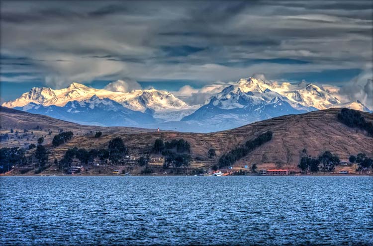
Imagine a blue expanse of water stretching under the boundless Andean sky, surrounded by majestic peaks whose summits are often covered in eternal snow. Somewhere there, on the border of wakefulness and dreams, where history intertwines with nature, lies a lake that has fascinated travelers, researchers, and indigenous peoples for centuries. This is Titicaca – a legendary lake that is not only a true natural wonder but also a treasure trove of culture and the mysteries of ancient civilizations.
Location
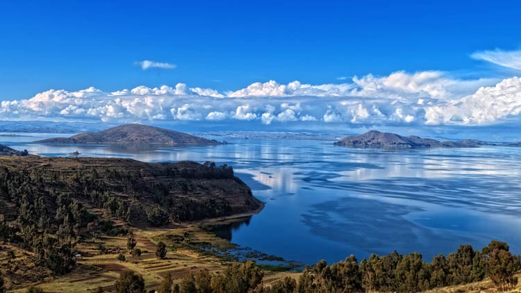
Lake Titicaca majestically extends across the Altiplano plateau, forming a natural border between two South American countries: Peru and Bolivia. It lies in the heart of the Central Andes, creating one of the most extraordinary landscapes in the world.
Name
The origin of the name “Titicaca” is a subject of debate, but the most popular theory suggests it comes from the Quechua and Aymara languages. In Quechua, “titi” means puma, and “kaka” means rock or mountain. It’s possible the name refers to the lake’s shape, which on some maps resembles a puma hunting a hare, or to a sacred rock on Isla del Sol (Island of the Sun) that was shaped like a puma.
Highest Lake?
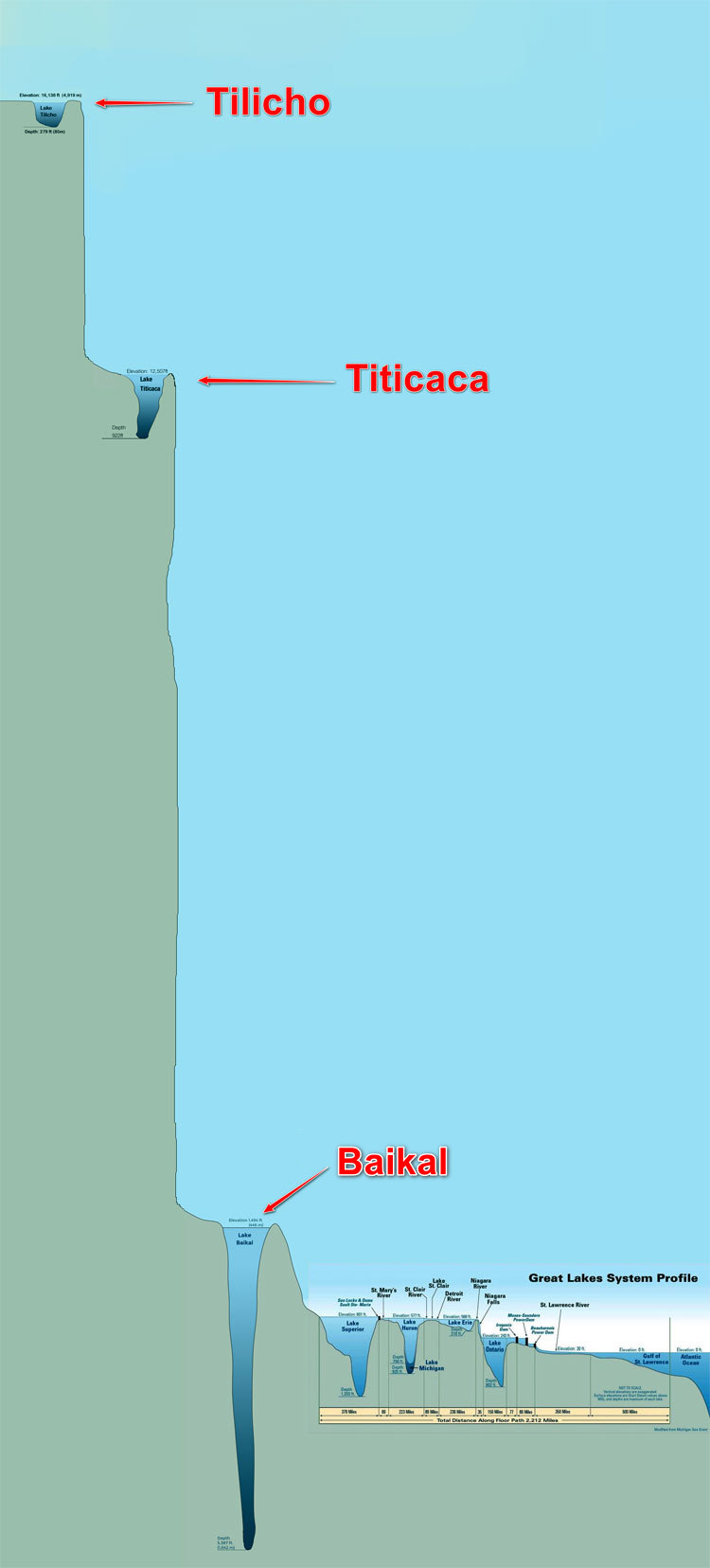
Lake Titicaca is famous for being the highest navigable lake in the world. It is also the largest of the high-altitude lakes. It sits at an elevation of approximately 3,812 meters (12,507 feet) above sea level, making it a true giant on the “roof of the world.” This extraordinary altitude significantly impacts the local climate and the daily lives of its inhabitants. For comparison, the highest peak in Poland, Rysy, is 2,499 meters (8,199 feet) above sea level.
However, it is not the highest lake overall – several lakes are located higher. But apart from Tilicho Lake (4,949 meters / 16,237 feet above sea level) and Lake Manasarovar (4,590 meters / 15,059 feet above sea level), these are generally more like large puddles, and some are only seasonal.
Characteristics
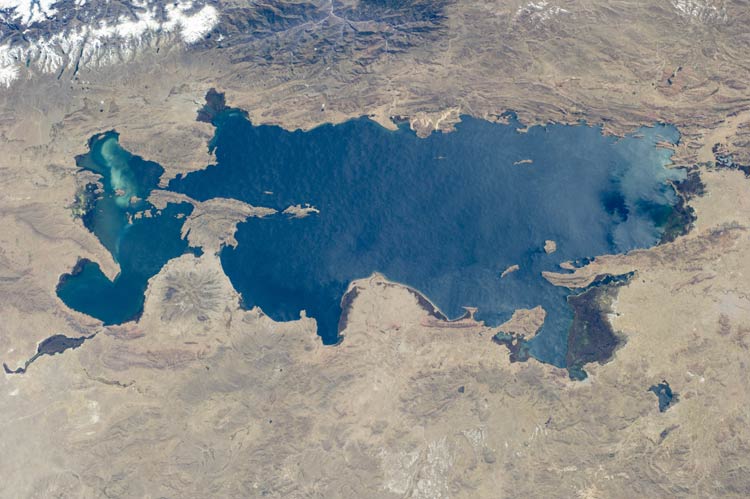
Titicaca is the largest freshwater lake in South America by volume and the second largest by surface area (after Lake Maracaibo, which is a lagoon). Its surface area spans approximately 8,372 km² (3,232 sq mi), with about 4,916 km² (1,898 sq mi) belonging to Peru and 3,456 km² (1,334 sq mi) to Bolivia. The lake boasts an impressive maximum depth of 281 meters (922 feet) in its deepest section, although its average depth is around 107 meters (351 feet).
The lake is fed by over 25 rivers, the most important of which are the Ramis, Coata, Huancané, and Suches, draining water from the vast Altiplano basin covering nearly 58,000 km² (22,394 sq mi). These rivers supply the lake with fresh water primarily from melting Andean glaciers and rainfall during the wet season.
Desaguadero
The only river flowing out of Titicaca is the Desaguadero, which flows south, emptying into the salty Lake Poopó (which unfortunately has frequently dried up in recent years due to climate change and excessive water consumption). Because Lake Poopó is an endorheic (landlocked) lake, the waters of Titicaca, though fresh, exhibit a slight salinity. This results from the accumulation of minerals over millennia, although it is low enough not to affect the ecosystem’s freshwater character.
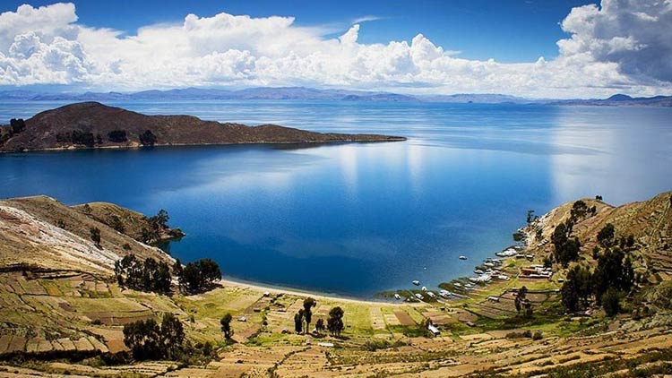
Two main parts
Lake Titicaca is divided into two main parts, connected by the narrow Tiquina Strait, which is only about 800 meters (0.5 miles) wide and can be crossed by ferry:
- Lago Grande (or Chucuito): The larger, northern part, characterized by deeper waters and more open spaces.
- Lago Huinaymarca (or Wiñaymarka): The smaller, southern part, shallower and more complex in terms of its shoreline, with numerous islands and bays.
These two parts differ slightly in hydrological conditions and biodiversity. Lake Titicaca’s unique ecosystem is home to many endemic species of flora and fauna, including rare fish (e.g., killifish from the genus Orestias) and the previously mentioned giant Titicaca water frog (Telmatobius culeus). The lake’s altitude and isolation have led many species to evolve independently, making it a valuable area for biological research and conservation. Temperature differences between the surface and deeper water layers, as well as seasonal currents, play a crucial role in the distribution of nutrients and oxygen within the lake.
Climate
The climate around Lake Titicaca is typical for the high-altitude Altiplano plateau. It is characterized by significant temperature fluctuations between day and night, as well as between seasons. Days are often sunny, but the the air is thin and cold. At night, temperatures drop significantly below freezing, especially during the winter months (from May to August). The average annual temperature is about 10°C (50°F). The lake’s influence, however, is noticeable – it acts as a thermal regulator, moderating extreme temperature drops along its shores. The rainy season lasts from December to March.
Geology of Lake Titicaca
Titicaca is a tectonic lake, meaning its depression was formed by movements of the Earth’s crust. Geologists estimate that the lake likely formed in the Miocene epoch, being a remnant of a much larger, inland sea called Lago Ballivian, which existed approximately 100 million years ago and covered significant areas of the Altiplano.


The uplift of the Andes, which are young and still growing mountains, played a crucial role in its formation. The uneven uplifting of individual mountain ranges led to the creation of depressions where water accumulated. Traces of ancient shorelines indicate that Lake Titicaca was once much larger, and unfavorable geological processes (likely related to the further uplift of the Andes) as well as intense evaporation led to the reduction of water levels to their current state.
The region around Lake Titicaca is characterized by a complex geological structure, with a predominance of sedimentary and igneous rocks, as well as metamorphic rocks in older Andean ranges. In the immediate vicinity of the lake, mainly lacustrine and alluvial deposits occur, testifying to its evolution. On a broader scale, the geological structure of the Western Cordillera in southern Peru and Bolivia, where Titicaca lies, includes Jurassic, Cretaceous, and Paleogene formations, such as the Arcurquina and Huanca formations, as well as magmatic intrusions from the Proterozoic and Lower Paleozoic. This area is also seismically active, and earthquakes influence the topography and erosional processes.
Despite its freshwater character (though there can be periods of increased salinity due to limited outflow), the chemical composition of Lake Titicaca’s waters shows remnants of the ancient sea, which explains the presence of certain fish species and other organisms. The lake’s waters are rich in minerals like calcium and magnesium, which influence their coloration, often ranging from blue to green, depending on the season and the presence of algae.
Islands
Lake Titicaca is home to many islands, some of which play a crucial role in the region’s culture and history:
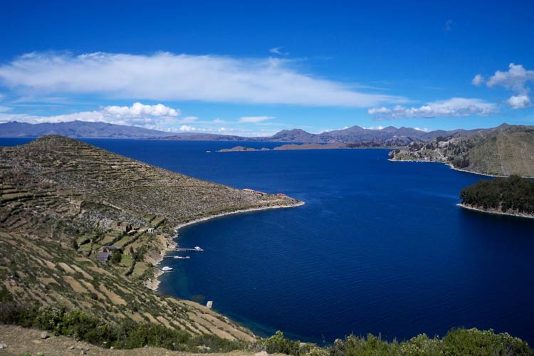
- Isla del Sol (Island of the Sun): The largest and most famous island. According to Inca legends, this is where the Sun was born, as well as the first ancestors of the Incas, Manco Cápac and Mama Ocllo. The island features numerous Inca and pre-Inca ruins.
- Isla de la Luna (Island of the Moon): A smaller island, also important in Inca mythology, where a temple dedicated to the Moon goddess was located.
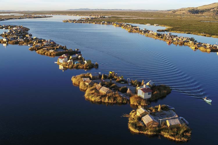
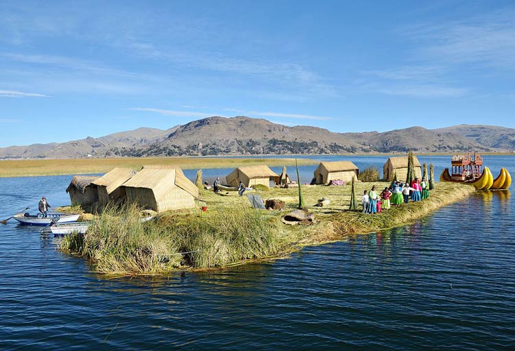
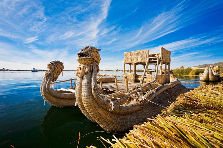
- Uros Islands: These are extraordinary, floating islands constructed from totora reeds (Schoenoplectus californicus ssp. totora) by the indigenous Uros people. The Uros have lived on these islands for centuries, sustaining themselves through fishing and tourism. Their unique culture and way of life fascinate visitors.
- Taquile: An island renowned for its rich weaving traditions. The inhabitants of Taquile, also Quechua-speaking, are famous for producing high-quality textiles, which are inscribed on UNESCO’s list of Intangible Cultural Heritage.
History
The history of Lake Titicaca is closely intertwined with the history of Andean civilizations. It was the cradle and center of many ancient cultures:
- Tiahuanaco (Tiwanaku): Even before the Incas, the powerful Tiahuanaco civilization flourished around Lake Titicaca (approximately 600 BCE – 1000 CE). Their impressive ruins, with the Gate of the Sun (Puerta del Sol) and Kalasasaya, bear witness to their advanced astronomical and engineering knowledge.
- Inca Empire: Lake Titicaca was considered a sacred place by the Incas, who believed in its divine origin. After conquering the Tiahuanaco civilization, the Incas incorporated the lake region into their empire, building numerous temples and settlements on its shores and islands.
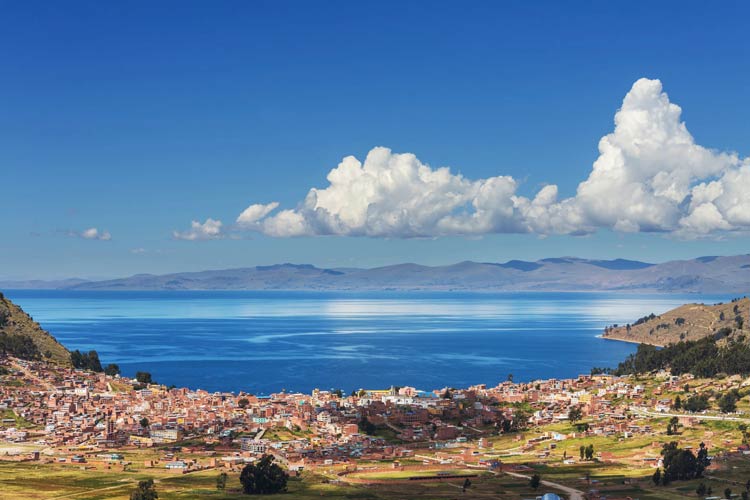
- Colonial and Modern Times: Following the Spanish conquest, the lake region became an important commercial and transport hub. Today, Lake Titicaca is a crucial element of the region’s economy, supporting fishing, agriculture, and, of course, rapidly developing tourism.
Detailed Data / Dimensions
Lake Titicaca
Below are the key physical parameters of Lake Titicaca, highlighting its monumental character:
- Elevation above sea level: 3,812 meters (12,507 feet)
- Surface area: 8,372 km² (3,232 sq mi) (approximately 4,916 km² (1,898 sq mi) in Peru, 3,456 km² (1,334 sq mi) in Bolivia)
- Maximum length: 190 km (118 miles)
- Maximum width: 80 km (50 miles)
- Maximum depth: 281 meters (922 feet) (in the Lago Grande section)
- Average depth: 107 meters (351 feet)
- Water volume: 893 km³ (214 cubic miles)
- Shoreline length: 1,125 km (699 miles)
- Main influent rivers: Ramis, Coata, Huancané, Suches
- Only effluent river: Desaguadero
- Water retention time: Estimated at approximately 100-150 years, meaning that a full water exchange in the lake takes a very long time, making it vulnerable to pollution.
- Water temperature: Varies from 10°C (50°F) to 14°C (57.2°F) at the surface, though it is more stable and colder at deeper levels.
Interesting Facts
- Sunken Cities: Legends speak of sunken cities beneath the waters of Titicaca, and underwater archaeological research has indeed discovered ruins of ancient structures, fueling myths of lost civilizations.
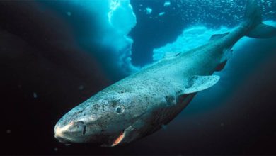
- Giant Frogs: The lake is home to a unique species of frog – the Titicaca water frog (Telmatobius culeus), which can reach up to 50 cm (20 inches) in length and is entirely aquatic. Unfortunately, it’s an endangered species.
- Totora Reed: This is a crucial element of life on Titicaca. This aquatic plant (Schoenoplectus californicus ssp. totora) is used not only to build the floating Uros islands but also boats (like the traditional balsas de totora), houses, and many other everyday items.
- “Andean Explorer” Train: One of the most picturesque train journeys in the world, connecting Cusco with Puno (a city on Lake Titicaca), offers unforgettable views of the Andean landscapes.
- Sacred Rituals: To this day, traditional ceremonies and rituals, often referencing Inca and pre-Inca beliefs, are performed on the shores and islands of Lake Titicaca, serving as a living testament to the region’s rich culture.
Lake Titicaca is a place where nature and history intertwine in an extraordinary way. It’s not just an impressive body of water, but also a living monument to the ancient civilizations that shaped this region. Visiting Titicaca transports you to another dimension – closer to the sky, closer to the past, closer to mysteries.